
Achieving Excellence: PEA Hike 2020
- Jan 9, 2021
- 3 min read
Updated: Jan 1, 2022
By Avern Tan
Updated: 1 January 2022

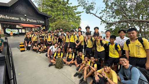
Left to right:
1st row: Joash Cheng, Wong Zheng Tat, Alex Chien, Joel Lim
2nd row: Damien Kang, Michael Ooi, Avern Tan, Jann Lim
知彼知己,百戰不殆
Know your enemy and know yourself, and you shall not fear the result of a thousand battles
~Sun Tzu
Setting foot on the journey towards the Pioneer Exploration Assessment Hike, the 8 Ventures knew that this was going to be a demanding challenge that would test their physicality, mental tenacity, and moral integrity. To conquer this battle, they would build up their endurance against various weathers and terrain, reinforce their orienteering skills, and learn new skills for this rendition of the hike.
Due to the Coronavirus pandemic, the hike would begin and conclude at the participant’s house and would entail both a route map and an area survey. Thus, in the 2 weeks leading up to the hike, they went for various hikes and training to familiarise themselves with the island and develop their skills. During these arduous and intensive 2 weeks, they additionally submitted their Pre-Assessment Submission (PAS), a report to be filled with hike details, simulated diet plans and packing lists as the actual hike would only entail 6 hours.
This year, the hike was around a mere 20km for most Ventures and consisted of 2 checkpoints of which they had to sketch the 1km by 1km grid of where the checkpoints are located. This was no easy task as the area survey was last done in 1994 and none of the seniors had any experience. As such, the Ventures had to refer to previously archived hike reports to gain knowledge.
Additionally, they had to take photos at these checkpoints, with themselves in them, to represent 4 aspects of the location - physical, environmental, economical and social. They then had to write an explanation to justify why they had chosen each picture for each respective aspect. Going into a new environment is never easy and that is why the Ventures must always prepare for it. That is why they had intensively conditioned themselves for 2 weeks before the hike.
The hike was only 6 hours, and the requirements consist of a rough submission, photos with captions on the hike day, and a completed sketchbook by the next day. This required strategic foresight on the Ventures part, and upon reaching the endpoint at 2 pm, they submitted their rough sketches to the respective examiners.
These were highly unpolished but sufficiently detailed to prove their thorough exploration of the checkpoint. Following this, the Ventures dedicated their efforts towards the photos, which required captions to explain the significance of specific landmarks and areas near the checkpoint. Finally, the last hurdle was the hike sketchbook.
Completing the sketchbook was no easy task as the Ventures demanded only the most detailed, neat and precise area surveys and map sketches. They worked tirelessly through the night to submit the sketchbooks on time by 8 am the next day. After working through a physically intensive and demanding hike, they pushed themselves to go beyond, pulling all-nighters to ensure that their work was up to the standard of a Catholic High Venture.
The Pioneer Exploration Hike was physically and mentally demanding, especially with the various unfamiliar challenges the Ventures faced amidst the adjustments due to COVID-19. However, prior training, preparation, and ability to adapt in the face of adversity, were the key factors that allowed them to come out victorious from the experience and achieve the high standards they set out to achieve, evidenced by their stellar results.
Attached below are samples of the route map and area survey completed on this hike:


Comments